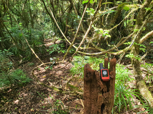
Testing the inReach Mini 2 – A bushwalk to Mt Superbus and a historical plane crash
On the 9th of April 1955, an emergency RAAF flight was transporting a patient from Townsville to Brisbane. Flying low through cloud it crashed into the rugged terrain surrounding Mount Superbus and has remained largely undisturbed for the past 70 odd years, serving as a memorial to those who lost their lives.
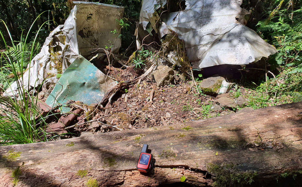
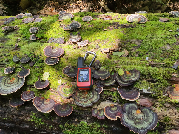
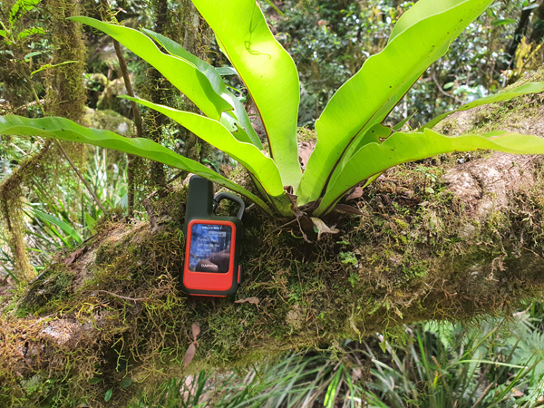
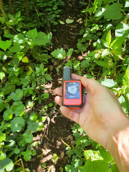
Garmin have just released the inReach Mini 2, so I thought that this rugged terrain would be a good testing ground for this satellite communicator and GPS as mobile phone reception is patchy at best so being able to send and receive messages via the Iridium satellite network is essential for communication.
The inReach Mini 2 supersedes the original inReach Mini and keeps the lightweight compact form factor while adding several significant improvements such as an improved battery life, high resolution screen (with a new menu structure), a trackback screen and a digital electronic compass.
There are two main features of the inReach Mini 2 – satellite communication and basic GPS navigation. The satellite communication functions and emergency SOS require a subscription to use. I ended up getting the Recreation Freedom plan so I could have the tracking on all the time. This includes 40 messages and is $55 per month, but you can pause it anytime so you only pay for the months you are planning on using it. More information on the various plans here: https://discover.garmin.com/en-AU/inreach/personal/#subscriptions
The inReach Mini 2 can be controlled by your phone or various Garmin devices such as the Fenix/Epix(Gen 2) watches. This means you can leave the mini 2 in your backpack and still send messages and activate SOS.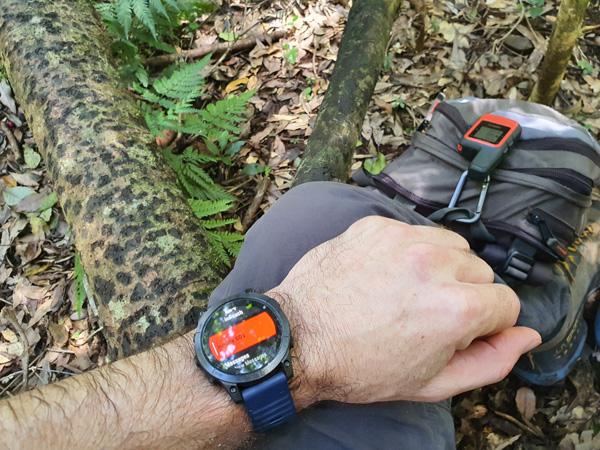
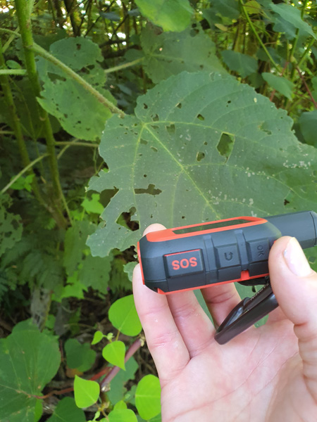
The Emergency SOS can be activated via your phone or compatible Garmin device if you can’t reach the inReach.
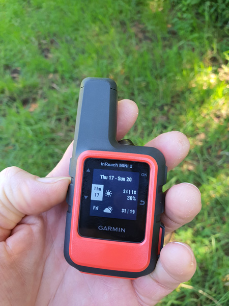
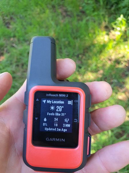
The main feature of the inReach is the satellite communication. This has three main features – messages, tracking and weather.
The messages work very much like an SMS – they are limited to 160 characters but can also include your location. You can send these to a phone number or an email address. You will need to have sent someone a message or have them in your address book in order for them to be able to send you a message as it costs one message from your plan every time you send or receive a message. Being able to send messages without phone reception is very useful for keeping people up to date with your progress and letting people know if there are any issues. Great if you are going to be a little late and you don’t want people to send out a search party! You can type out messages directly on the device, but it is painfully slow. I recommend pairing it with your phone and using the Garmin Explore app, which is much faster.
Messages will show up on the device and your phone if you are running the Explore app.

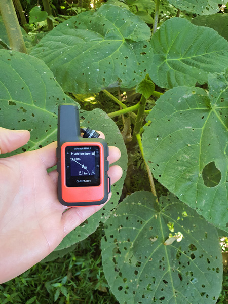
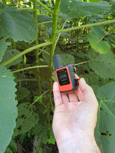
While the navigation is very basic, it’s enough to get you to a waypoint and back or follow a trail that someone has shared online.

With the default settings, battery life is advertised as up to 14 days with a full-sky view or 4 days with moderate tree cover. I had full tree cover for almost the whole hike and used about 30% battery during the 8 hour trek.
Overall the new features of the inReach Mini 2 wouldn’t make you rush out to get one if you already have the original inReach Mini. Still, the small form factor and extra battery life make it a winner if you don’t already have a satellite communicator.
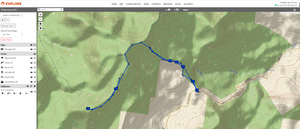
If you’re looking to walk this trail as well, I’ve linked the GPX trail file here to download to your own handheld.
inReach Mini 2 vs inReach Mini Specs| inReach Mini | inReach Mini 2 | |
| Dimension | 2.04” x 3.90” x 1.03” (5.17 x 9.90 x 2.61 cm) | 2.04″ x 3.90″ x 1.03″ (5.17 x 9.90 x 2.61 cm) |
| Display Size | 0.9″ x 0.9″ (23 x 23 mm) | 0.9″ x 0.9″ (23 x 23 mm) |
| Display Resolution | 128 x 128 pixels | 176 x 176 pixels |
| Display Type | sunlight-readable, monochrome, transflective memory-in-pixel (MIP) | Sunlight-readable, monochrome, transflective memory-in-pixel (MIP) |
| Weight | 3.5 oz (100.0 g) | 3.5 oz (100 g) |
| Battery type | Rechargeable internal lithium-ion | Rechargeable internal lithium-ion |
| Battery life | Up to 90 hours at 10-minute tracking (default) | Up to 14 days at 10-minute tracking send interval with standard activity recording with full sky view |
| Up to 35 hours at 10-minute tracking with 1-second logging | Up to 4 days with moderate tree cover (default) | |
| Up to 24 days at 30-minute tracking power save mode | Up to 5 days at 10-minute tracking send interval with high detail activity recording with full sky view | |
| Up to 1 year when powered off | Up to 2 days with moderate tree cover | |
| Up to 30 days at 30-minute tracking send interval with standard activity recording with full sky view | ||
| Up to 10 days with moderate tree cover | ||
| Up to 1 year when powered off | ||
| Waterproof | IPX7 | IPX7 |
| Interface | micro USB | USB-C |
| Waypoints/favorites/locations | 500 | 1000 |
| Courses | N/A | 100 |
| Tracks | Single dynamic track | N/A |
| Navigation Track Log | Single auto overwrite track log | N/A |
| Activities | N/A | 200 |
| Navigation Routes | 20, 500 points per route | N/A |
| High-sensitivity receiver | Yes | Yes |
| GPS | Yes | Yes |
| Galileo | No | Yes |
| QZSS | No | Yes |
| Compass | No | Yes |
| GPS compass (while moving) | Yes | Yes |
| Weather | Yes | Yes |
| Point-to-point navigation | Yes | Yes |
| Interactive SOS | Yes | Yes |
| Send and receive text messages to SMS and email | Yes | Yes |
| Send and receive text messages to other inReach device | Yes | Yes |
| Exchange locations with other inReach device | Yes | Yes |
| MapShare compatible with tracking | Yes | Yes |
| Virtual keyboard for custom messaging | Yes | Yes |
| Send waypoints to MapShare during trip | No | Yes |
| Send route selection to MapShare during trip | No | Yes |
| inReach remote compatible | Yes | Yes |
| Compatible with Earthmate | Yes | No |
| Compatible with Garmin Explore™ app | No | Yes |
| Garmin Explore website compatible | Yes | Yes |
| Garmin Pilot™ app compatible | No | Yes |
| Connections Wireless Connectivity | yes (BLUETOOTH®, ANT+®) | Yes (Bluetooth®, ANT+®) |